Open spaces as the key to the integration issue of historical site reconstruction projects: a cross‑cultural comparison
March 2025
Historic city
Public space
Urban heritage
Reconstruction
- Qian Liu , First Author , Politecnico di Milano
- Yiran Liu , Politecnico di Milano
- Laura Pezzetti , Politecnico di Milano
Type
Journal
Journal
Built Heritage, 2025, 9(10)
Projects
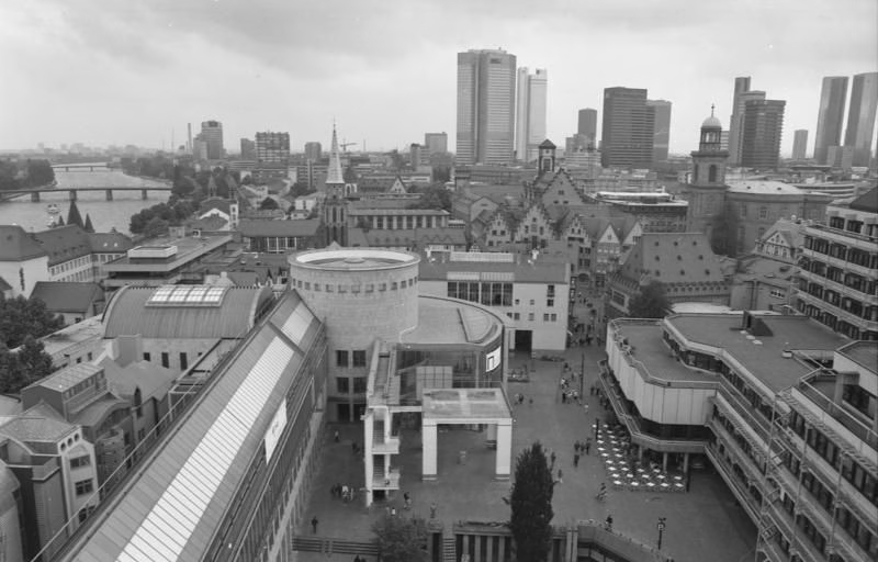
Dom-Römer area, view from the Dom tower in 1988
Abstract
The reconstruction of historical sites, while a controversial practice, has been common in both Germany and China to mitigate the cultural losses incurred during wars and subsequent redevelopment. This paper contributes to the broader discourse on reconstruction by examining the critical significance of integration between the ‘old’ and ‘new’, which means establishing a smooth and close transition between the reconstructed sites and the surrounding urban environment, as well as the key role of open space in facilitating this integration. Through morphological analysis and site surveys, the Yanghe Tower in Zhengding, China, and the Dom-Römer in Frankfurt, Germany, are compared in this paper. The comparison reveals that the integration issue related to Yanghe Tower was not adequately addressed because the key role of open space was neglected. This paper also examines the sociocultural factors that influenced the design strategies of the two projects, suggesting that future Chinese reconstruction efforts can significantly benefit from attention to the key role of historical open spaces.
Keywords
Open space, Reconstruction, Historical sites, Integration
Author contributions
- Qian Liu collected materials of the two projects through site visiting and archival research and wrote the main texts of the comparative analysis.
- Yiran Liu conducted the literature review, contributed to preparing the drawings and editing the texts.
- Laura Pezzetti supervised the research and contributed to the analysis of the Yanghe Tower project.
Key figures
Dom-Römer area, view from the Dom tower in 1988 (Source: Bundesarchiv, B 145 Bild-F078972-0001/CC-BY-SA 3.0, CC BY-SA 3.0 de, https://commons.wikimedia.org/w/index.php?curid=5472041)
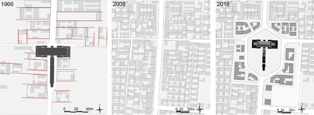
Yanghe Tower area, roof plans. Left: 1960, when the wooden hall was destroyed; Middle: 2008, before reconstruction; Right: 2018, after reconstruction (Source: the author based on DOQs from the U.S. Geological Survey and Google Earth images)
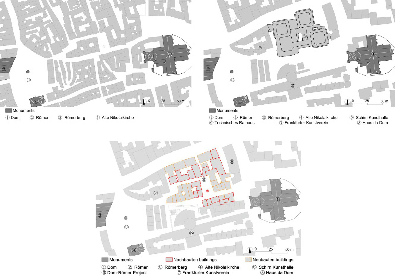
Dom-Römer area, roof plans. Above-left: 1862; Above-right: 2010, before reconstruction; Below: after reconstruc tion (Source: the author, based on public domain maps from Ravensteins Geographische Verlagsanstalt, and Google Earth images)